Day 3: Gränsleden Akkajaure Västenden – Sårgåjávrre
A tale of swamp crossings and rainbows
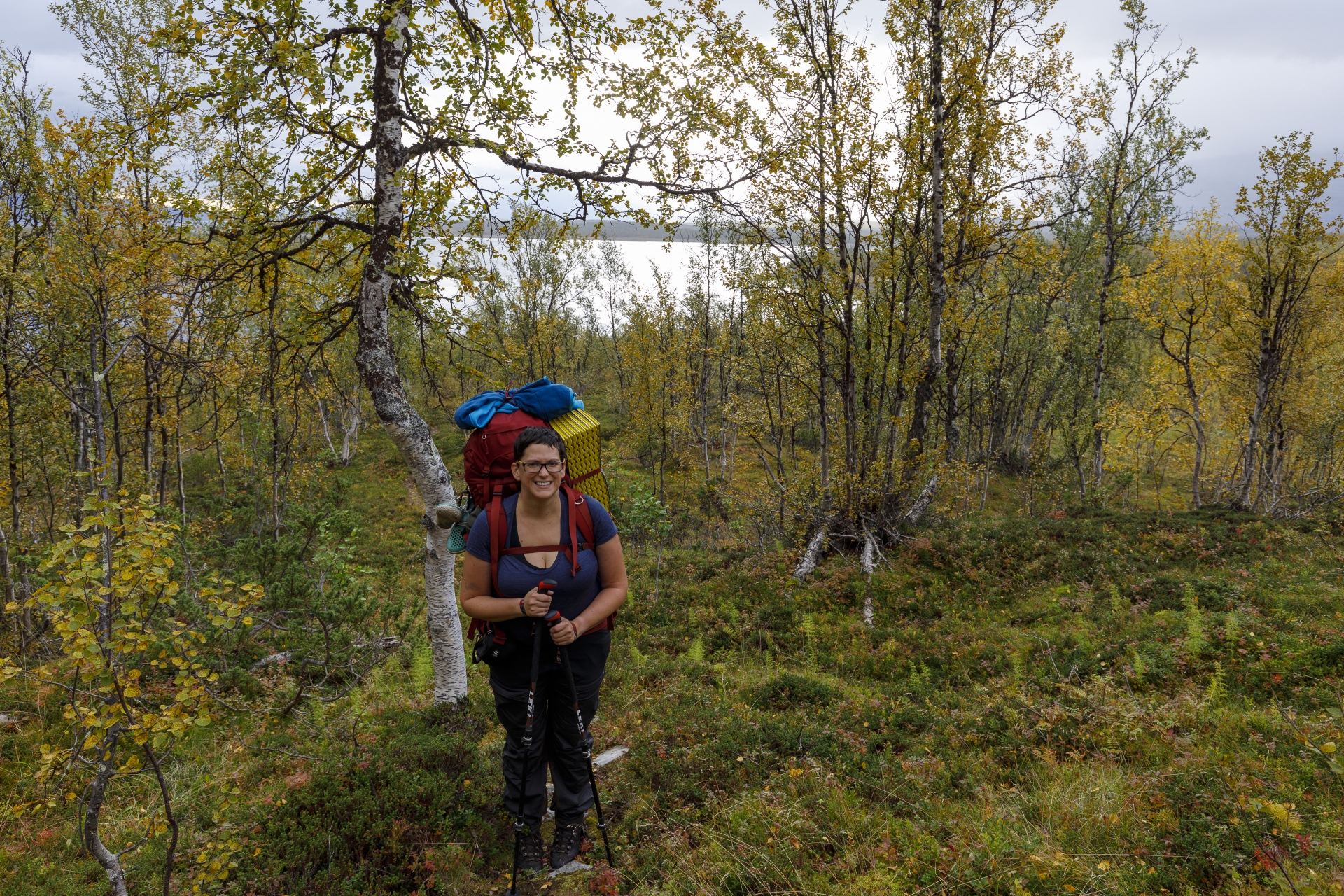
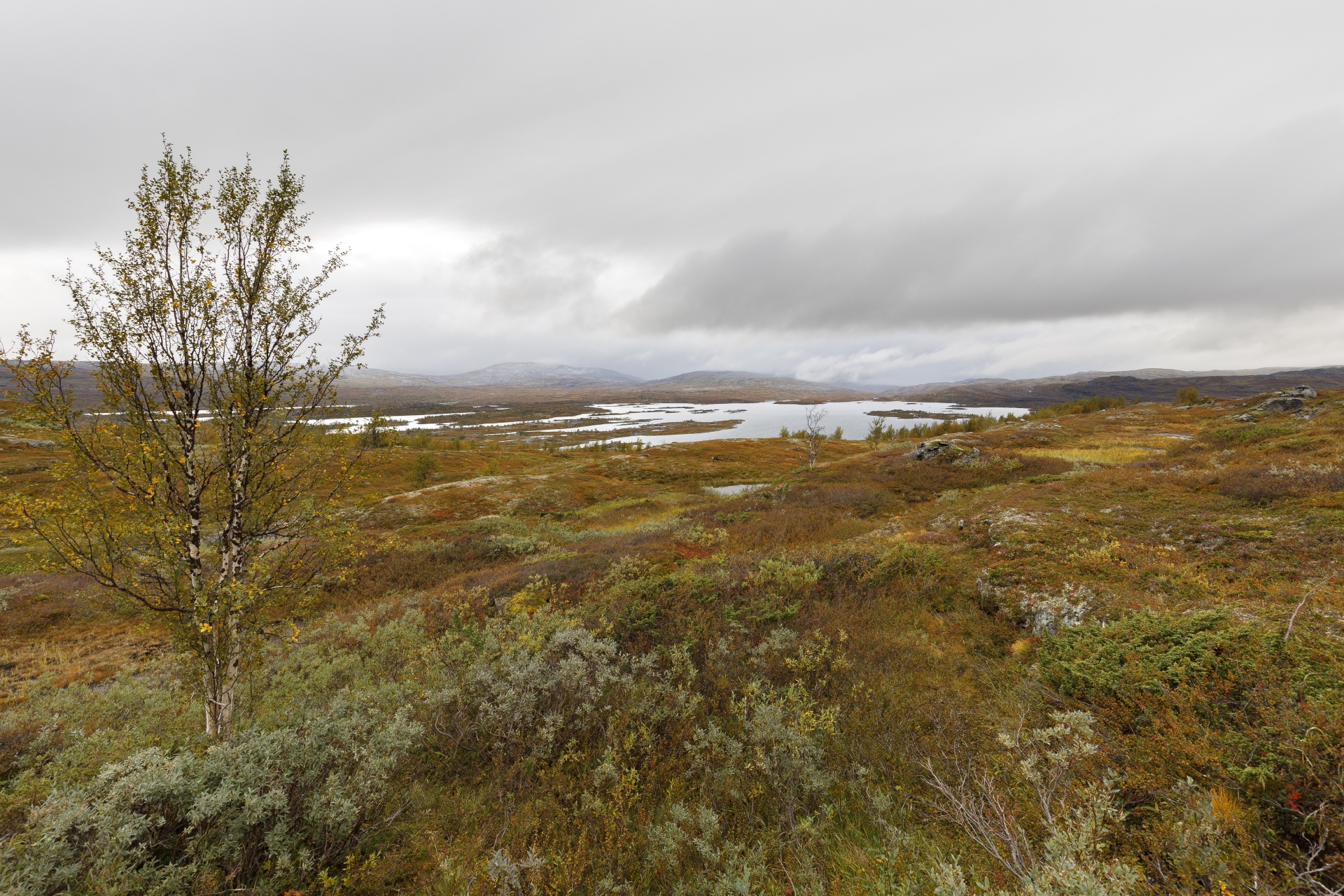
A good hiking day starts with a steep ascent – or something like that. From our campsite at the lake we go up through the birch forest. It is shortly after 10 o’clock, once again we used our usual hour to pack. Today’s schedule after yesterday’s exertions is clear: we go as far as we can – and we accept that we need one day longer to Røysvatn than planned. Akkajaure Västenden, our campsite by the lake, is 460 m above sea level and from there we go up to the 736 m high Vakkatjavelk. The rest of the way follows more or less the contour lines along the slope of Gálavárddo before descending again to Sårgåjávrre (500 m altitude).
 Anstieg nach Akkajaure Västenden, © Markus Proske — Canon EOS 5D Mark IV, EF16-35mm f/4L IS USM, 24mm, 1/60s, Blende 8, ISO 250
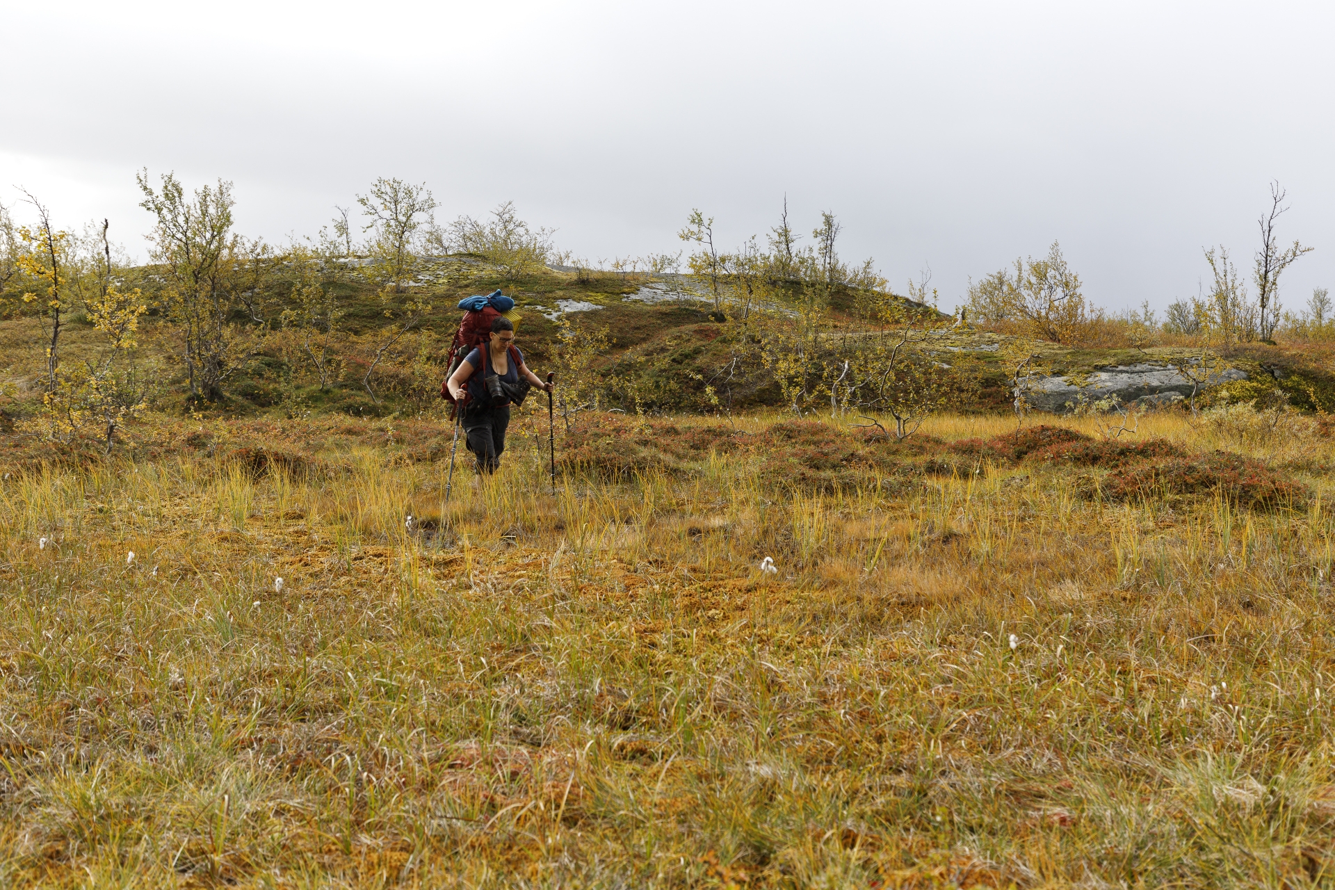
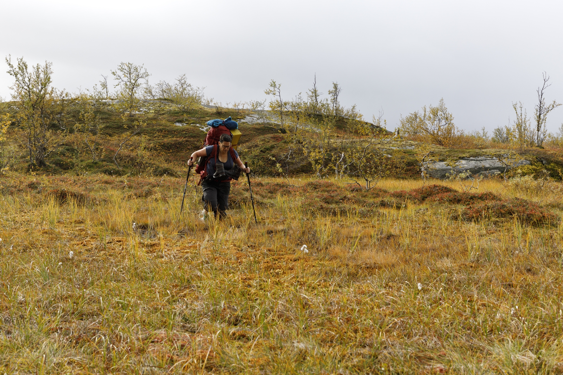
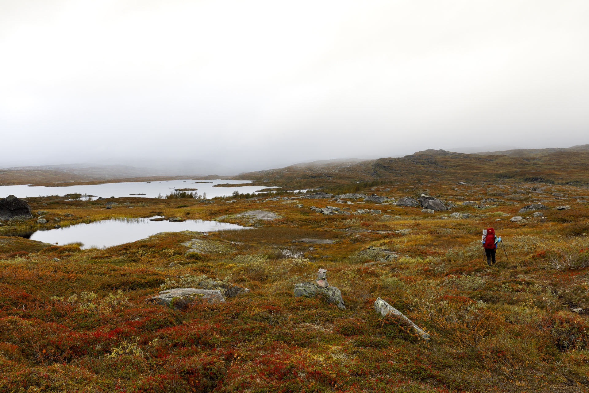
After the birch forest in the steep first part of the ascent, the terrain later becomes much less steep and we walk in a landscape of many hills and swamps, of course still tending upwards, but actually it is a steady little up and down. At times, the path leads through very swampy places that can sometimes be easily avoided, sometimes less good or not at all. At one point we stand in front of an extensive swamp area that is not easy to avoid, but we find quite fresh footprints at a narrow spot.
Let’s go! I (Markus) with a running start – not so easy with a 30 kg backpack – and uff, just before the end I almost get stuck with one foot and just save myself to the other side. Shoe slightly wet inside. This is too insecure for Elisabeth, she looks for another crossing, decides for an alternative route and takes the fordshoes for safety’s sake.
 Querung einer Sumpflandschaft – Teil I, © Markus Proske — Canon EOS 5D Mark IV, EF16-35mm f/4L IS USM, 35mm, 1/100s, Blende 5.6, ISO 100
You can see for yourself, it looks controlled and safe. But controlled is not always good – a bit later she sinks with her right foot up to her knee – and doesn’t manage to pull it out again. But she slowly sinks with her left foot too. The following photo shows the moment shortly before.
 Querung einer Sumpflandschaft – Teil II: In too deep!, © Markus Proske — Canon EOS 5D Mark IV, EF16-35mm f/4L IS USM, 35mm, 1/100s, Blende 5.6, ISO 100
Before you ask – there are no more photos, the photographer quickly put his camera on a quite dry spot and rushed to help. Well, he wanted to, because I didn’t get closer than 2 m without sinking myself, the place is much nastier than my crossing. Elisabeth finally only came out by letting herself sink to the front on her knees (and hands including trekking poles) and then slowly pulled her feet out again and crawled forward on all fours to me.
Conclusion: A little bit wetter than planned, both Vivobarefoots still on her feet, mood splendid – at least after high dosage of chocolate 😉
For the future: Running over is better, ford shoes are overestimated and it would have been smarter to bypass the spot very far, even if there were already footprints …
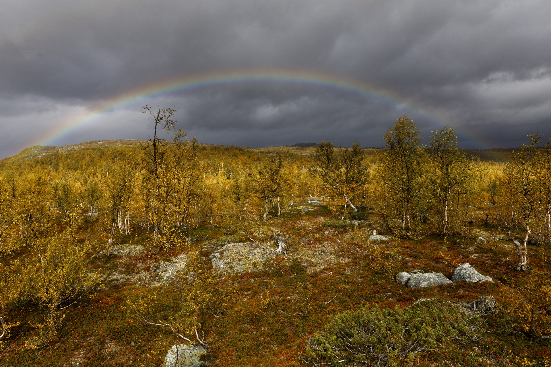
The weather today is mixed, cloudy in the morning, then we went halfway in the sun. The view ahead shows us bad weather over the whole horizon, with dark clouds and obviously heavy rain. But together with the sun’s rays this results in an indescribable light atmosphere and to round it off – in the truest sense of the word – a wonderful rainbow appears. Directly above the hill we are walking towards!
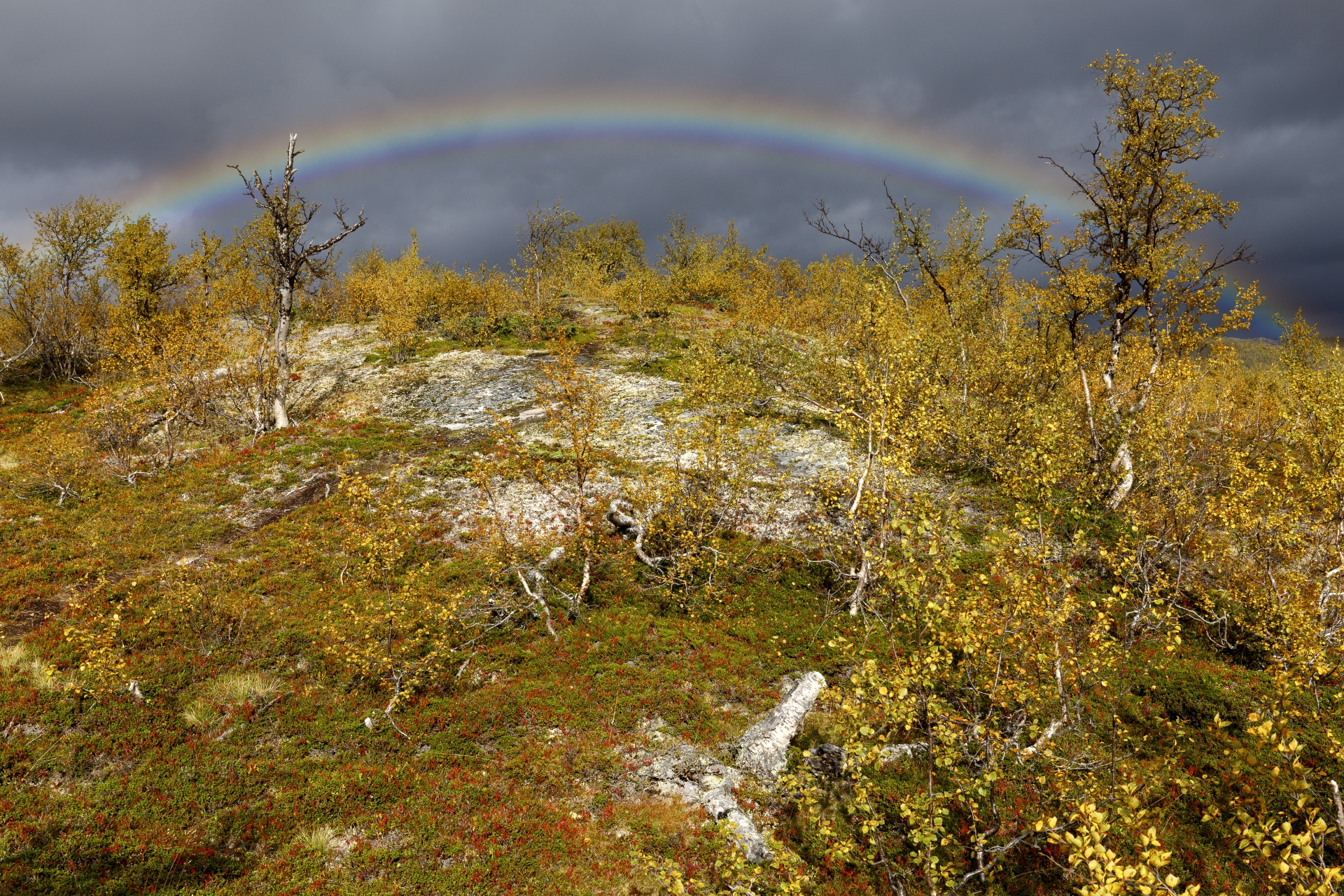 Rund, © Markus Proske — Canon EOS 5D Mark IV, EF16-35mm f/4L IS USM, 35mm, 1/160s, Blende 11, ISO 100
As I absolutely want to photograph the rainbow from above, I run up the hill – as fast as possible. At peak time it didn’t work out with 30 kg luggage, but at least I reach the top in time to bring you this picture:
Wir gehen nicht grad in Richtung Schönwetter…., © Markus Proske — Canon EOS 5D Mark IV, EF16-35mm f/4L IS USM, 28mm, 1/160s, Blende 11, ISO 100Shortly thereafter this dreamlike rainbow is gone, but we see more in the course of the day, but not so splendid anymore. Our way still leads through a picturesque birch and swamp landscape with great autumn colours!


From a hill we look back and see what distance we have covered since our start the day before yesterday. If you go down from the sky in the middle of the picture, you’ll see the ridge that runs from the left to the lake. Behind this ridge is our starting point Ritsem.
 Blick zurück auf Akkajaure Västenden und ganz hinten liegt Ritsem (nicht sichtbar), © Markus Proske — Canon EOS 5D Mark IV, EF16-35mm f/4L IS USM, 20mm, 1/125s, Blende 11, ISO 100
 Vakkatjavelk, © Markus Proske — Canon EOS 5D Mark IV, EF16-35mm f/4L IS USM, 35mm, 1/80s, Blende 8, ISO 100
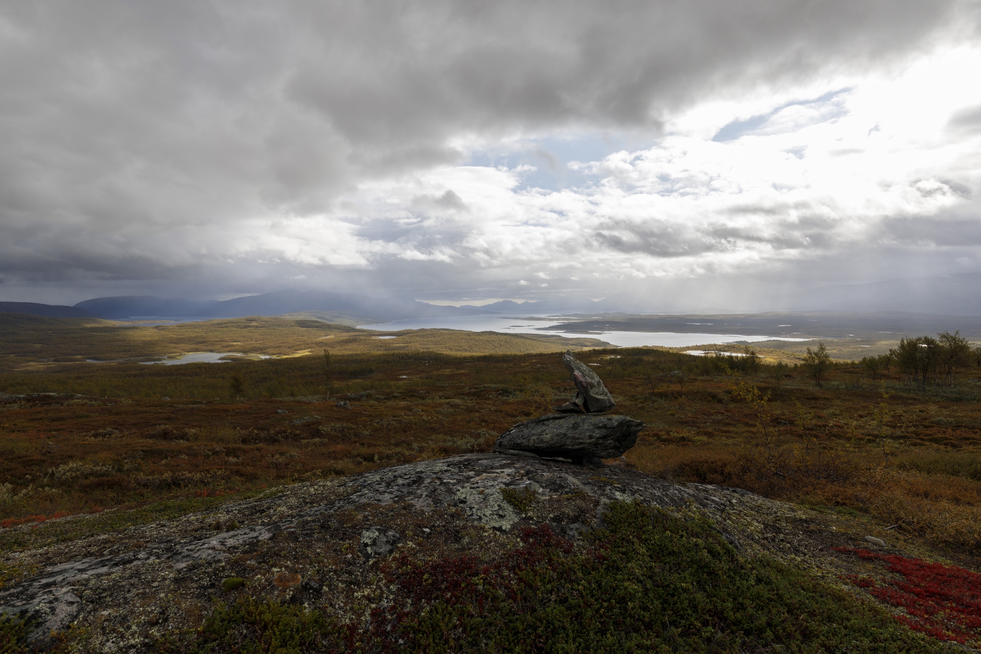
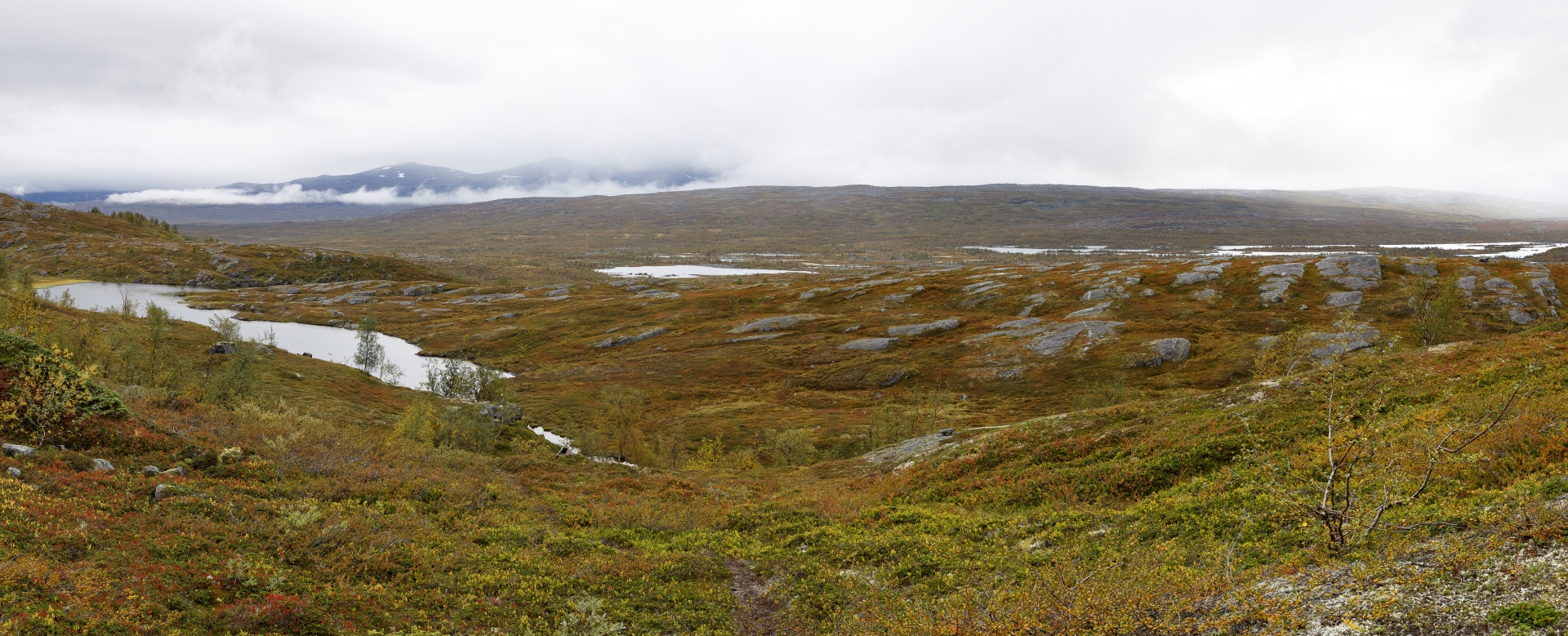
In the meantime we have reached Vakkatjavelk and are now walking along the slopes of Skiejátjåhkkå and Gálavárddo. On the map it looks totally nice, more or less on one contour line, but the reality is different. It goes up and down, the way is partly exhausting and just before the Gálavárddo rest hut we go down a steep, muddy and water-overcrowded path, which could also be called a small brook. But now we have a nice view of the river landscape of the Sårgåjåhkå.
 Traverse des Hanges des Skiejátjåhkkå, © Markus Proske — Canon EOS 5D Mark IV, EF16-35mm f/4L IS USM, 35mm, 1/80s, Blende 8, ISO 200
We reach the rest hut at about 14 o’clock. Juhuu, we covered 6 kilometres – in 4 hours. So with short breaks, photo stops and a rescue operation a hot average of 1½ kilometres per hour. This is far below our normal speed. We see the cause in several factors: Backpack weight (30 or 23 kg), this year we have far less hiking kilometres in our legs than in other years (and above all hardly any with really much weight) and finally, the path here is simply not easy. The latter will be confirmed, at the Nordkalottleden we will hardly have less weight on our backs, but we will make much faster progress.

, © Markus Proske — Canon EOS 5D Mark IV, EF16-35mm f/4L IS USM, 35mm, 1/60s, Blende 8, ISO 200")
At the rest hut we meet Lothar from Germany, who has already pitched his tent here. While we heat ourselves water and eat together a calorie-rich pack from our stock, we have plenty of time to chat. Lothar talks about a long-distance trip with an all-wheel Iveco in South America and of course also about his current tour. Like us, he started in Ritsem, one day ahead of us and, like us, is clearly behind his expectations regarding the completed route. His backpack is a mobile wall unit called Haglöfs 110 and he carries an impressive knive and binocular. So it’s like a meeting of the ultralight group, what can I say – my equipment is halfway optimized, but I carry a lot of photo equipment. Oh, do you remember the footprints I followed through the swamp? Here we have the man who got stuck before us! 😀
After a 1.5-hour break we say goodbye to Lothar and go on, wildly determined to cover a few more kilometres today.
After a 1.5-hour break we say goodbye to Lothar and go on, wildly determined to cover a few more kilometres today.
Generally speaking, the way is completely clear: keep the altitude at about the same level, always along the slope. In detail it’s not that easy, the marked path sometimes turns surprisingly 90° to climb the mountain. So that the hiker does not recognize these markings, strategically reindeer are placed for distraction. The hikers are then happy about reindeer, observe and photograph them and after a while say sentences like: “We haven’t seen any markings for a long time” or “The path has been better” or “Are you sure that this is the path?”. At this point, at the latest, experienced “Lustwandler” turn around and look for the last known mark and actually, it was an arrow to the north anyway! See for yourself – here with one of the evildoers:
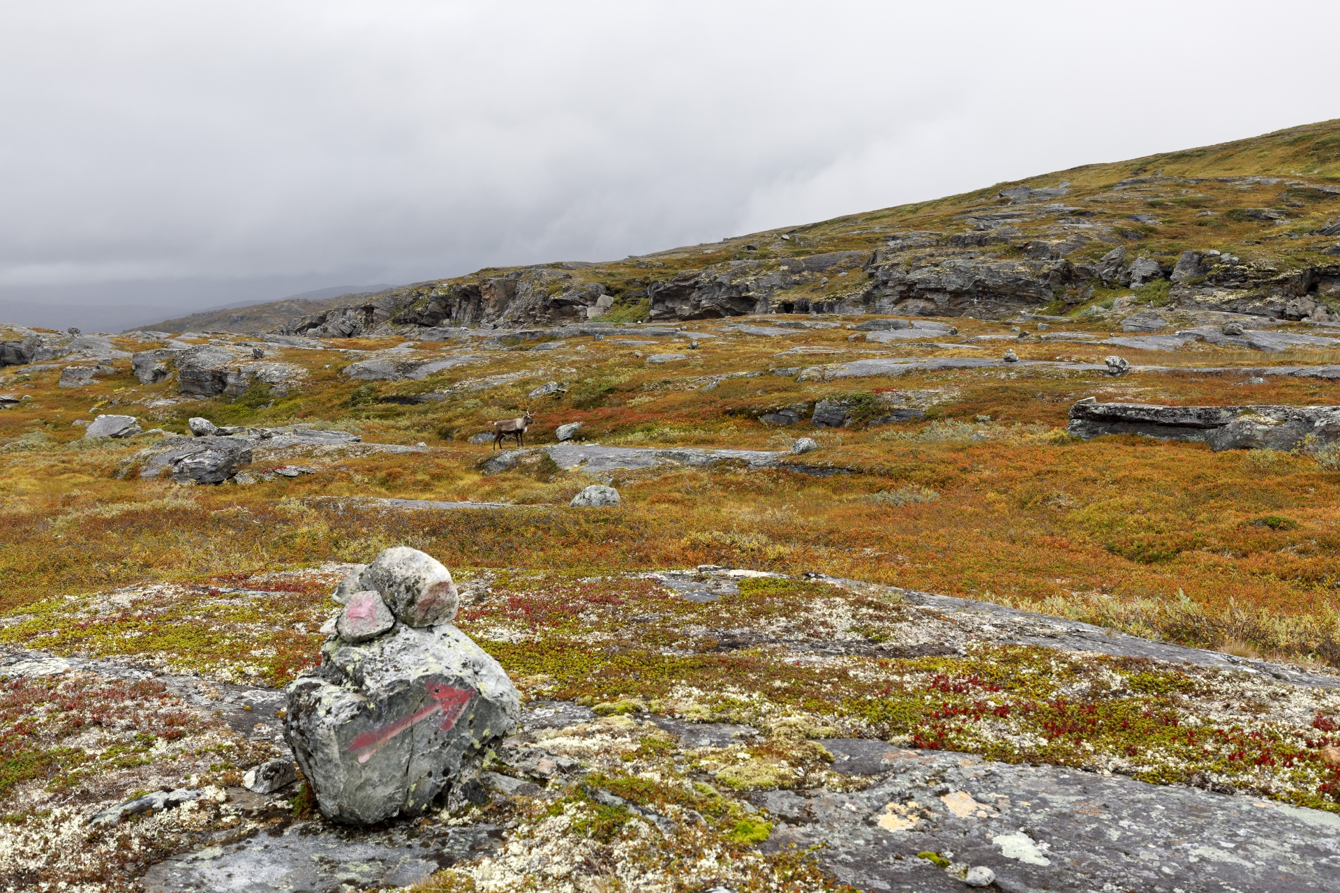 Die Feinheiten der Wegführung sollte man trotz Ablenkung nicht übersehen…, © Markus Proske — Canon EOS 5D Mark IV, EF16-35mm f/4L IS USM, 35mm, 1/80s, Blende 8, ISO 250
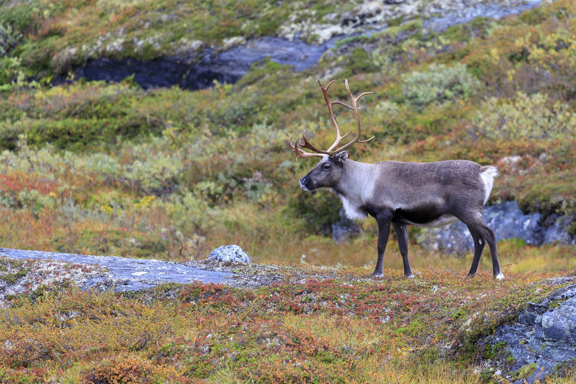 Rentier, © Markus Proske — Canon EOS 5D Mark IV, EF70-300mm f/4-5.6L IS USM, 300mm, 1/500s, Blende 5.6, ISO 1250


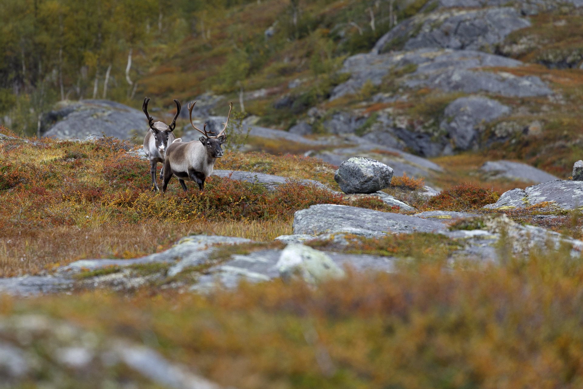 Rentiere, © Markus Proske — Canon EOS 5D Mark IV, EF70-300mm f/4-5.6L IS USM, 300mm, 1/500s, Blende 5.6, ISO 1250
Away from small problems finding the way becomes a little bit easier and we move faster. The sun is gone now, we don’t go short sleeved anymore but with our fleeces. From time to time it drips easily but otherwise remains stable. After the long slope crossing follows a very gentle descent, the following photo was taken at 17 o’clock, there we are already a nice piece deeper. A little later we meet the next group of reindeer.
 Flußlandschaft des Sårgåjåhkå, © Markus Proske — Canon EOS 5D Mark IV, EF16-35mm f/4L IS USM, 24mm, 1/60s, Blende 8, ISO 200

 Sårgåjávrre, © Markus Proske — Canon EOS 5D Mark IV, EF16-35mm f/4L IS USM, 16mm, 1/60s, Blende 8, ISO 200
We go until just after 19 o’clock and are at this time still approx. 1 kilometre away from the bridge. So we made a lot of progress today and were on our way at a reasonable speed after the break.
It is cold and windy when setting up the tent, we cool down quickly and disappear accordingly fast in our sleeping bags, we cook in the apse, eat in the tent. And then there is already night rest!
It is cold and windy when setting up the tent, we cool down quickly and disappear accordingly fast in our sleeping bags, we cook in the apse, eat in the tent. And then there is already night rest!
 Elisabeth auf dem Gränsleden, links der Sårgåjávrre, © Markus Proske — Canon EOS 5D Mark IV, EF16-35mm f/4L IS USM, 35mm, 1/80s, Blende 8, ISO 400
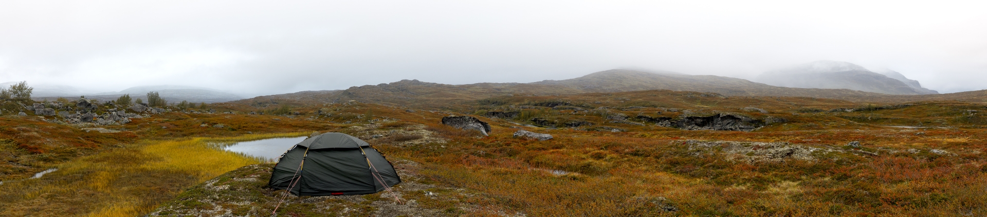 Perfekter Zeltplatz, © Markus Proske — Canon EOS 5D Mark IV, EF16-35mm f/4L IS USM, 35mm, 1/80s, Blende 8, ISO 1600
Leave a Reply
Want to join the discussion?Feel free to contribute!