Day 2: Ascent to Roche Écrite (2,276 m) and down to Dos d’Âne (930 m)
Heathland and enchanting cloud forest
We didn’t really sleep well that first night. Everything is wet and smells a bit moldy. The mood does not improve when we put on the wet clothes at 6 o’clock in the morning. Socks, underwear, shirt, pants, fleece: all wet. We try to take it with humor and trust the reports that this is the worst of all accommodations on our tour.
We go to the main hut – cold as well – and eat our breakfast, consisting of rusks, margarine and jam. I must admit, at that moment I thought enviously of the many clever couples who spend their honeymoon on the Maldives with their only worry whether to jump into the sea before or after the delicious breakfast buffet.
We go to the main hut – cold as well – and eat our breakfast, consisting of rusks, margarine and jam. I must admit, at that moment I thought enviously of the many clever couples who spend their honeymoon on the Maldives with their only worry whether to jump into the sea before or after the delicious breakfast buffet.
In the room we pack everything into our – wet – backpacks and at 7:45 we start the ascent. 400 meters of altitude on about 4 km are waiting for us. On the signpost, the ascent time is given as 1.5 hours. The summit is usually in the clouds early, often already at 10 o’clock in the morning. We start at a brisk pace so that we can still enjoy the view. The path is easy, the markings excellent.
 Aufstieg in der Morgensonne zum Roche Écrite, © Markus Proske — NIKON Z 7, NIKKOR Z 24-70mm f/2.8 S, 49mm, 1/100s, Blende 8, ISO 140

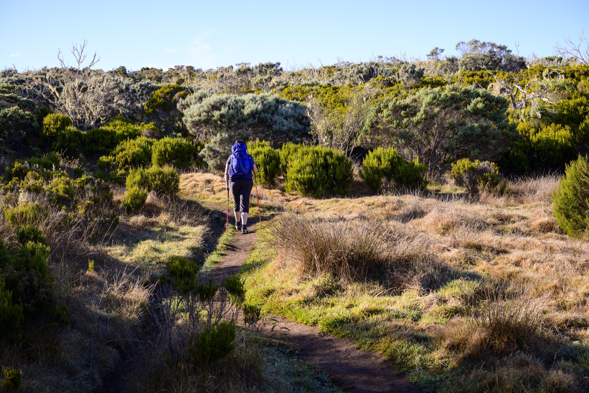
The path crosses the Plaine des Chicots, the landscape becomes more open, with wide grassy areas, heather plants, broom and large slabs of lava. The vegetation becomes sparser. But we are not lonely – today we meet many trail runners.
On the next two pictures you can see two very typical plants of this high heath landscape.
On the next two pictures you can see two very typical plants of this high heath landscape.
 mit Morgentau, © Markus Proske — NIKON Z 7, NIKKOR Z 24-70mm f/2.8 S, 70mm, 1/800s, Blende 2.8, ISO 64")
, © Markus Proske — NIKON Z 7, NIKKOR Z 24-70mm f/2.8 S, 70mm, 1/1600s, Blende 2.8, ISO 64")
Two viewpoints are also located along the trail (the one a little off the trail is called “Mare aux Cerfs” after the pond located there). The view to the east shows the Cirque des Salazie, to the west the Cirque de Mafate can be seen.
The clouds are already coming up and Markus increases the speed. We just float over the lava slabs 😉
The clouds are already coming up and Markus increases the speed. We just float over the lava slabs 😉
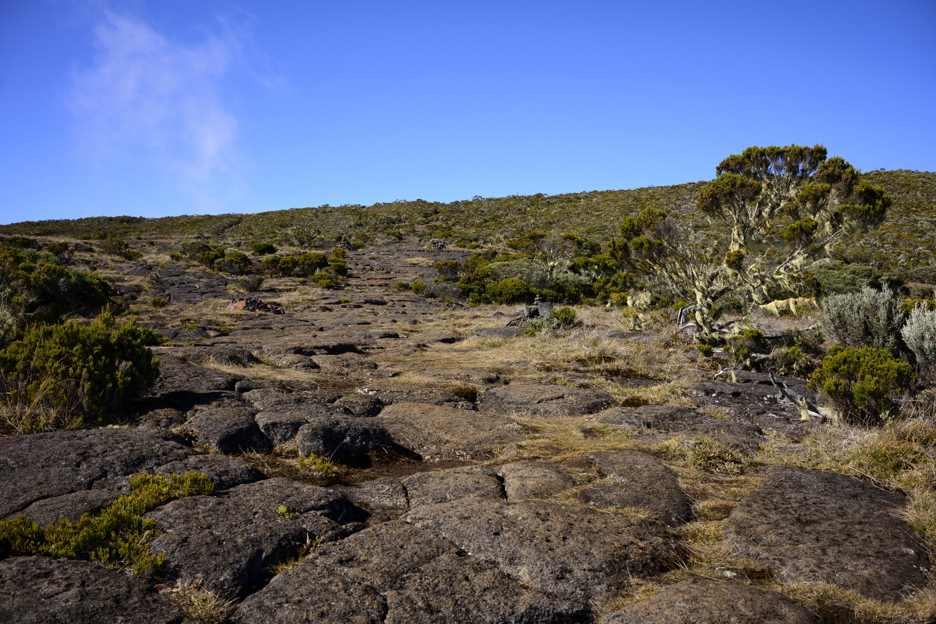 Aufstieg über Lavaplatten, © Markus Proske — NIKON Z 7, NIKKOR Z 24-70mm f/2.8 S, 34mm, 1/320s, Blende 8, ISO 64
Valérie and Benoît also go our way – but without backpack. Shortly before the summit they overtake us. At 9:15 we reach the antenna and shortly after the summit. Briefly we have good visibility, a few minutes later mountains and valleys are in the clouds. Everywhere on the rocks around the trigonometric point of La Roche Ecrite are inscriptions, often first names, which also give this place the name “Roche Ecrite”, described rock.
Some venture far forward to the edge for a good view. We prefer to observe a little further back.
And we are a little annoyed not to have been up here earlier, so we would probably have had longer to enjoy the impressive view. Deep below us lies the Cirque de Salazie and Grand Îlet with the crest of Cimendef and Piton Bémale to the west.
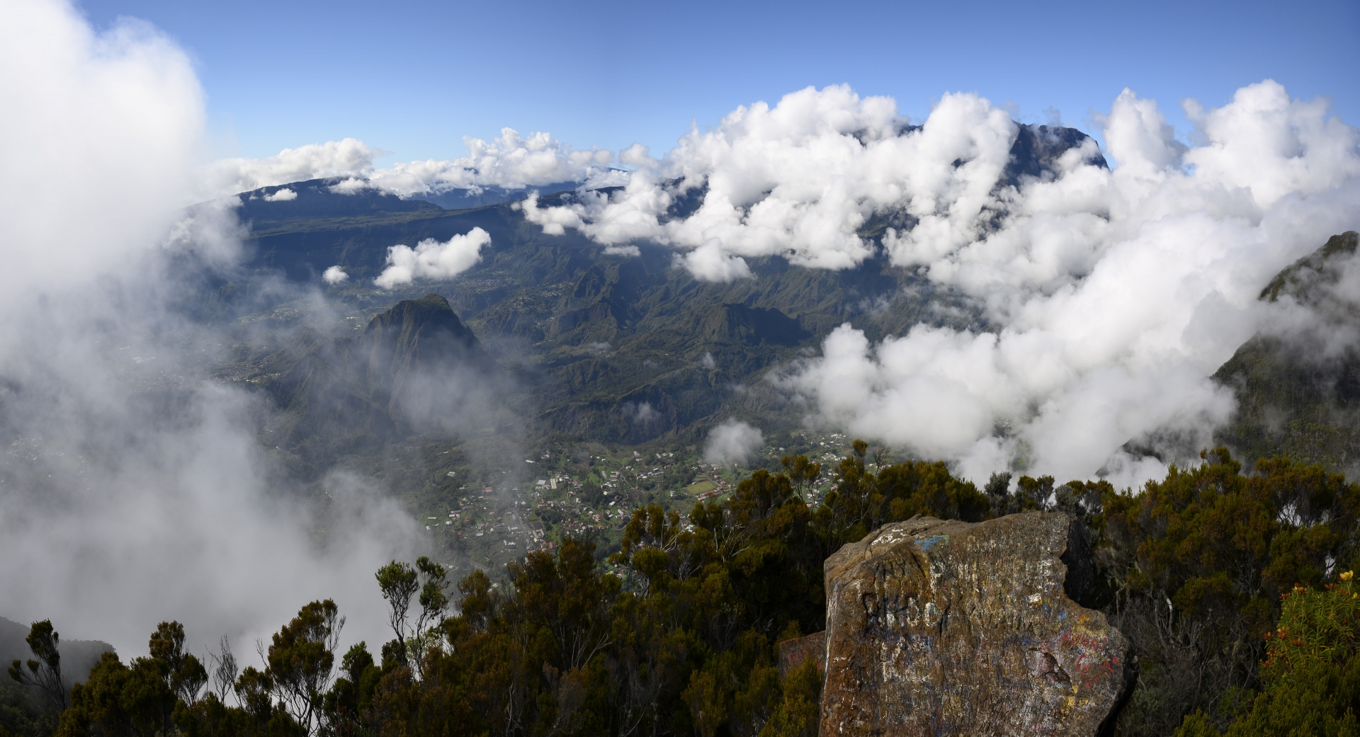 Blick vom Roche Écrite (2.276 m) auf den Cirque de Salazie (ganz hinten der Piton des Neiges weitgehend in den Wolken), © Markus Proske — NIKON Z 7, NIKKOR Z 24-70mm f/2.8 S, 24mm, 1/125s, Blende 11, ISO 64
 Steiler Abhang in den Cirque de Salazie, Blick auf Grand Îlet, © Markus Proske — NIKON Z 7, NIKKOR Z 24-70mm f/2.8 S, 24mm, 1/80s, Blende 11, ISO 64


We also catch a first glimpse of Cirque de Mafate – we’ll be down there tomorrow evening
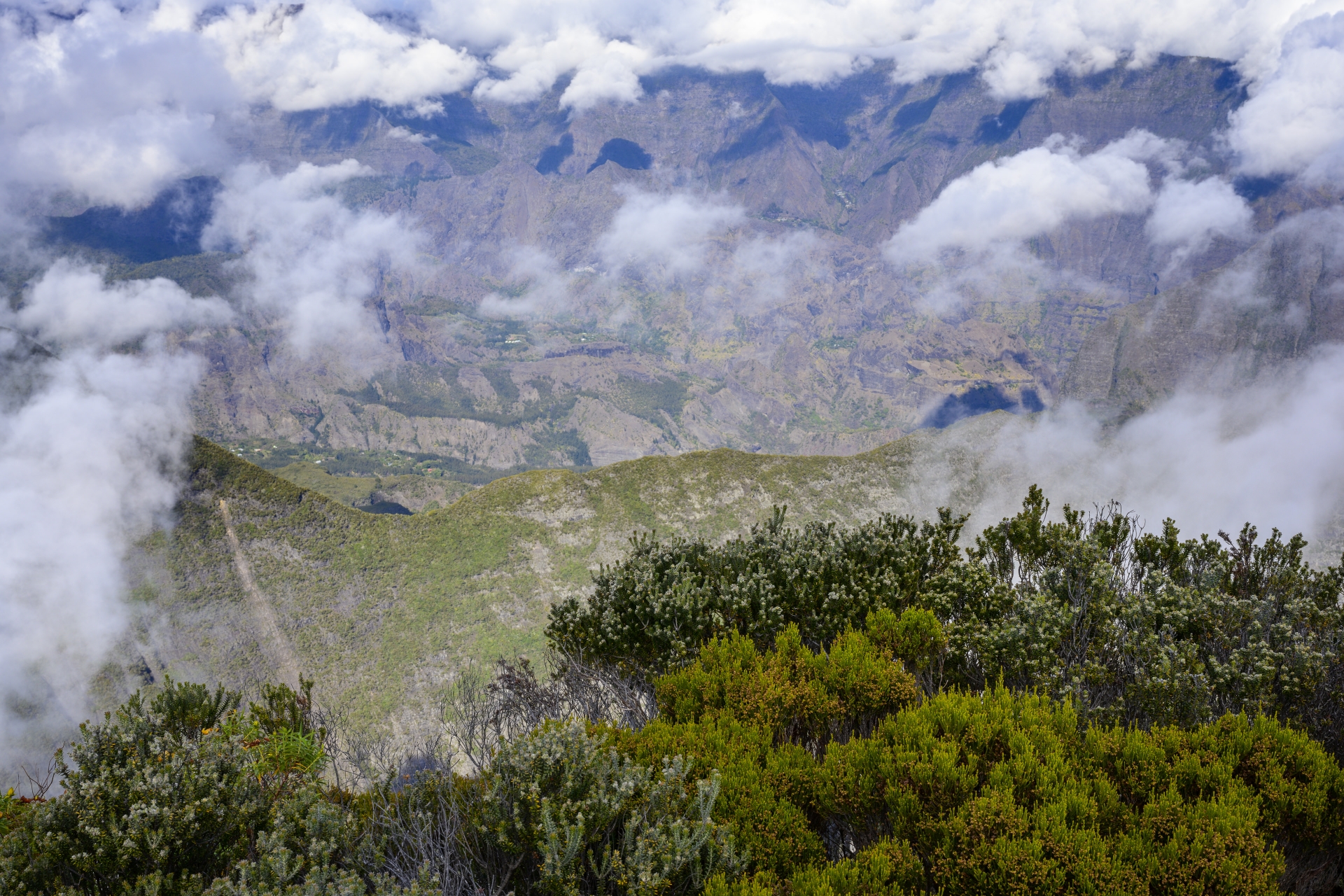 Blick in den Cirque de Mafate, © Markus Proske — NIKON Z 7, NIKKOR Z 24-70mm f/2.8 S, 41mm, 1/100s, Blende 11, ISO 100
We spend 30 minutes at Roche Écrite, then we go back the same way to the gîte and to the GR R2. After a short break, we start the descent to Dos d’Ane at 11:30, which is indicated with 2:45 hours.
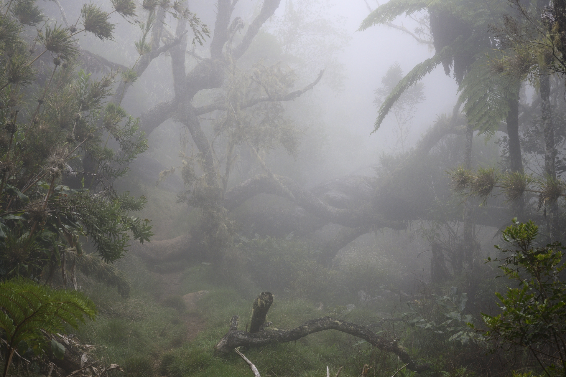
The descent through the fabulous rainforest is incredibly beautiful. The humidity is high, but due to the moderate temperatures this is not unpleasant. Again and again we stop and look, try to memorize this sight and hope that many more such passages await us on our route.
Now I’m glad I didn’t choose the Maldives as the destination for our honeymoon!


Mood: perfect!
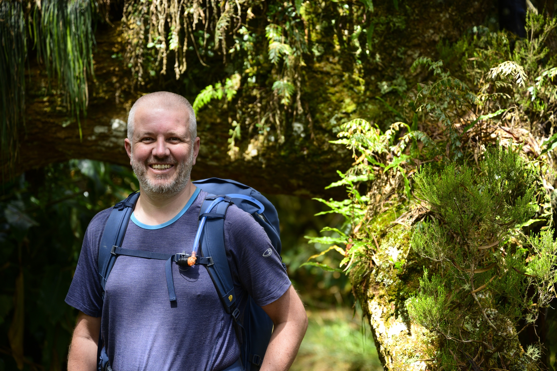 Markus, © Elisabeth Zenz — NIKON Z 7, NIKKOR Z 24-70mm f/2.8 S, 70mm, 1/125s, Blende 2.8, ISO 64
The path is muddy, slippery and has many high steps. It is quiet except for the varied chirping of birds; we hardly see any animals. Except for a few giant spiders that stretch their meter-sized webs far above us. These unbelievable impressions cause that we need the double time for the descent than indicated. But we also suspect that the times are given for trail runners. ?
 Elisabeth, © Markus Proske — NIKON Z 7, NIKKOR Z 24-70mm f/2.8 S, 24mm, 1/50s, Blende 11, ISO 180


At the top of the ridge, the path is particularly adventurous. Through the deep clouds, it seems as if our path leads to nowhere and there is also nothing to be seen to the left and right. Maybe that’s good, because in the tour descriptions you can read that this passage is a challenge for people with fear of heights, because it goes straight down to the left and right. For a long time we have always heard the crowing of roosters deep down below us.
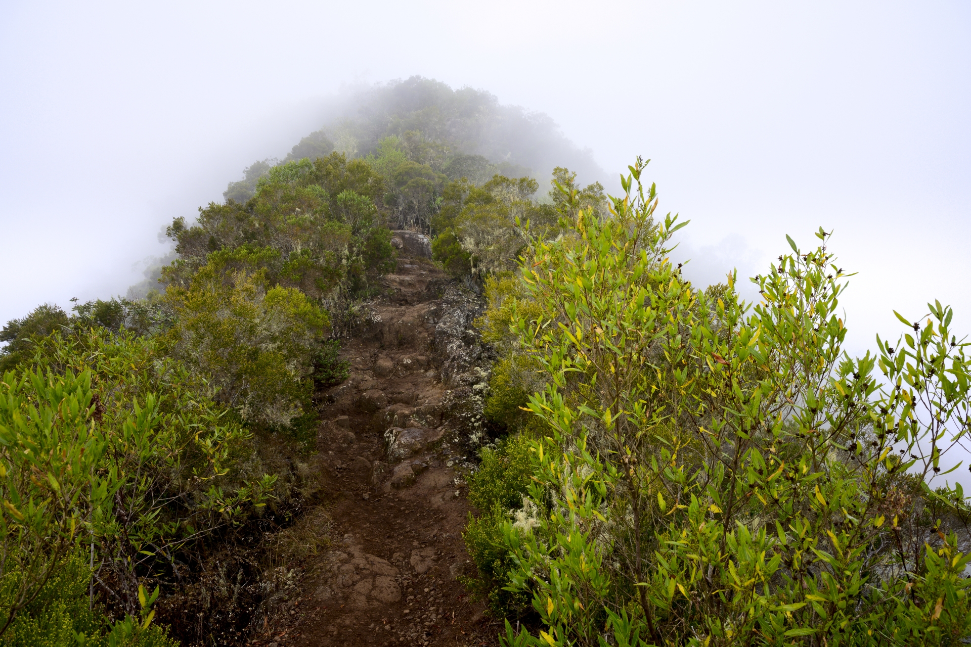 Schmaler Grat zwischen dem Cirque de Mafate und Dos d’Âne, © Markus Proske — NIKON Z 7, NIKKOR Z 24-70mm f/2.8 S, 24mm, 1/50s, Blende 11, ISO 160
We take the direct, steep way to the parking lot Cap Noire, which we reach at 16:30. The path over the Cap Noire, which promises a breathtaking view, is pointless in today’s visibility conditions. An extreme pity!
Lustwandler tip: We recommend taking a rest day in Dos d’Âne. Leave before dawn, go up to Cap Noir and then enjoy the Cap Noir circuit and the impressions that it brings.

, © Markus Proske — NIKON Z 7, NIKKOR Z 24-70mm f/2.8 S, 34mm, 1/80s, Blende 8, ISO 160")
From the parking lot, take the main road to the gîte (3 km, 45 minutes). Alternatively, you can take the bus for this unattractive route.
The gîte is extremely beautiful and not to compare with the first cottage. The view down to the sea is also impressive.
The gîte is extremely beautiful and not to compare with the first cottage. The view down to the sea is also impressive.

, © Markus Proske — NIKON Z 7, NIKKOR Z 24-70mm f/2.8 S, 55mm, 1/125s, Blende 8, ISO 125")
Two-bed room, hot shower and great food: For appetizers, spring rolls, cheese puffs, sweet potato pancakes; for mains, rice, lentils, salad, chicken and fish; then apple tart with vanilla ice cream and mango cream. In addition rum punch with mango, red wine and water. At 9 p.m. we lie in bed, tired and satisfied.


A few facts about the walking time:
From Gîte to 1492 m junction Route Forestière de la Plaine d’Affouches: 3:15 hours (instead of 1:30 hours).
1230 m junction Dos d’Âne par Grand Coin 20 min or par Roche Verre Boutaille 35 min (here we walk exactly the indicated time)
Parking Cap Noir (+ 15 min to the indication on the sign)
From Gîte to 1492 m junction Route Forestière de la Plaine d’Affouches: 3:15 hours (instead of 1:30 hours).
1230 m junction Dos d’Âne par Grand Coin 20 min or par Roche Verre Boutaille 35 min (here we walk exactly the indicated time)
Parking Cap Noir (+ 15 min to the indication on the sign)
And here is the elevation profile of the first two days. 🙂
(Kartendaten © OpenStreetMap contributors, Track Lustwandler.at)
(Kartendaten © OpenStreetMap contributors, Track Lustwandler.at)


This article has been semi-automatically translated as a service for foreign users. See details here.
Leave a Reply
Want to join the discussion?Feel free to contribute!